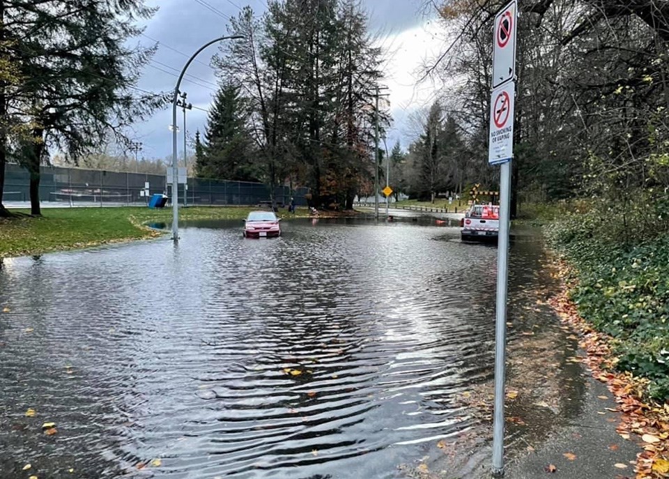
The Tri-Cities is in for another atmospheric river event starting tonight (Nov. 24).
The good news is that it's expected to be short-lived and not as intense as the previous heavy rainfall that led to floods and mudslides across B.C. between Nov. 13 and 15.
However, up to 80 mm of downpour is predicted for Coquitlam, Port Coquitlam, Port Moody, Anmore and Belcarra over a 24-hour cycle that ends Thursday night (Nov. 25).
Environment Canada issued its rainfall warning as of 4:53 a.m. today as a storm is heading in the Tri-Cities' direction, which is also set to include winds of up to 30 km/h — 60 km/h by the Pacific Ocean.
"Localized flooding in low-lying areas is possible," the national service explained in its statement.
"Heavy downpours can cause flash floods and water pooling on roads. Don't approach washouts near rivers, creeks and culverts."
In the last three-day storm, nearly 210 mm was accumulated at Coquitlam's Burke Mountain rain gauge on Harper Road, including 97 mm on Nov. 14 when the rain reached its peak downpour.
City environmental and worksite bylaw officer Angela Yeung is encouraging residents to prepare their homes, businesses and worksites for the incoming inclement weather.
"Erosion and sediment control measures must be implemented and maintained," she urged.
"Disturbed surfaces should be well protected and catch basin filters should be cleared of debris or removed in areas prone to flooding."
HOW CAN I PREVENT POTENTIAL FLOODING?
The City of Coquitlam has provided some basic safety measures to consider before, during and after a rainstorm, including avoiding any unnecessary travel.
At your own homes, you're encouraged to:
- Check on neighbours who might need assistance, including prior to the storm to see if they need help to get prepared
- Use the city's catch basin map to find catch basins close to your property and keep them clear of leaves and debris
- Ensure gutters on buildings are clear of leaves and debris, and rake up leaves to prevent them from plugging drains
- Secure anything that might blow away in a storm, including garbage carts and lawn furniture
- Bring carts in from the curb after they have been emptied to avoid the risk on high winds knocking them onto the road
- If you have a missed collection due to a knocked-over cart, contact Waste Connections Canada at 604-636-3520
If you must travel across the city in the next day or two, consider the following:
- Follow all road signs, including detours and road closures
- Do not walk or drive around barricades on roads as they have been placed there to protect public safety
- Treat any traffic signal that is dark or flashing as an "all-way stop"
- Report downed power lines to BC Hydro (1-800-224-9376) or *HYDRO (*49376) on your mobile
- If you come across a downed or damaged power line, stay back at least 10 metres
If you need to get in your daily 10,000 steps:
- Postpone hiking through forested parks and trails, in particular pathways along ravines or steeper slopes due to increased landslide risk
- Stay clear of fast-flowing rivers, creeks and potentially unstable riverbanks
- Watch for falling trees or branches
- Watch out for and avoid walking or driving through pooling water on roads and pathways
- Do not wade through flood water
More information is available on the City of Coquitlam's website.
The post below explains Port Coquitlam's extreme weather strategy and how its residents can be prepared for 'atmospheric' rainstorms.
Port Coquitlam issues extreme weather planning guide as more rain expected to pummel the region https://t.co/7iEgqy68ZK pic.twitter.com/aHOa6PhVgR
— Tri-City News (@TriCityNews) November 23, 2021


